LocateMySchool
LocateMySchool
What is LocateMySchool?
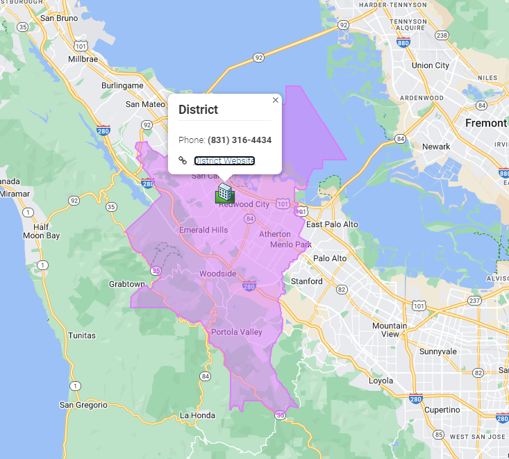
One of the most impactful trends in recent years is the use of GIS software to visualize data for enhanced communication and usability. LocateMySchool is a web-based school locator and attendance boundary map that utilizes advanced GIS software to streamline the process of accessing school boundaries, directions, and other essential information. This service offers a convenient online tool for communicating school boundaries, directions, and other details about your schools and district to the community. Parents can easily access current school attendance areas, obtain walking, driving, or bicycling directions to schools, and view additional helpful information such as bus stop locations and upcoming events. School and district staff also benefit from a user-friendly tool for addressing inquiries, providing information to board members, and supporting school planning.
We are ready
(831) 316-4434


Features of LocateMySchool:
Interactive custom location and assignment website for use simultaneously by the public, constituents, and staff
Driving, walking, and biking directions from any address to assigned zone
Multi-language support
Personalized with your logo and colors
Multiple layers with customized points such as voting locations, central or regional offices, or other meaningful points of interest
Links to other resources for the district and/or
individual zones
Reviewed and dated quarterly
Smart-phone and tablet accessible

why choose us ?
Transforming School Boundaries, One Click at a Time
Expertise in School Zone Customization
At David Johnston GIS, we specialize in the transformative power of technology to simplify complex geographic data, particularly in school boundaries. Our advanced GIS tools are meticulously designed with precision and ease-of-use in mind, ensuring that you have access to the most reliable and user-friendly resources for managing school zones.
Proven Track Record of Success in School Boundary Mapping
Our commitment to excellence and customer satisfaction sets us apart. We consistently deliver outstanding results, making us the preferred choice for educational boundary mapping solutions.
Comprehensive Support & Partnership in School Zone Management
We offer comprehensive support and partnership, ensuring you navigate your educational journey with ease. Explore our services today to see how we can help you effectively manage school zones and achieve your goals.
Scalable School Boundary Solutions
Whether you're a small school or a large district, our GIS solutions are scalable to meet your needs. We offer flexible options that grow with your organization, ensuring you always have the right tools for managing school boundaries at your disposal.
Data Accuracy and Reliability in School Zones
We emphasize the importance of accurate and reliable data in school zone mapping. Our rigorous quality control processes ensure that the information provided by our tools is precise and dependable, giving you confidence in your decision-making.
Exceptional Customer Service for School Boundary Solutions
We pride ourselves on delivering exceptional customer service. Our dedicated support team is always available to assist with any questions or issues, ensuring a smooth and satisfactory experience for all our clients.
Save Time with School District Boundary Mapping
Incorporating LocateMyDistrict into your website allows visitors to view school district boundaries, get directions from addresses to zones, access aerial maps, and find contact information. This GIS software-based service ensures that the public can easily find the information they need anytime, reducing phone calls and boosting staff efficiency.
Ensure Accuracy in School District Boundaries
By leveraging GIS software technology, we accurately plot your school district boundaries on an online map, avoiding the pitfalls of hand-drawn maps. Our data and boundaries are updated quarterly, reflecting new streets based on Google Maps data, ensuring precise and current information.
Ease of Use in School District Boundary Tools
The setup for LocateMyDistrict is straightforward. Simply provide your district and zone boundaries, and our GIS software handles the rest. The application is user-friendly for all skill levels, allowing visitors to search for addresses, view school district boundary assignments, get directions, and find points of interest on various devices.
testimonial
what they say ?
Lorem ipsum dolor sit amet, consectetur adipiscing elit. Ut elit tellus, luctus nec ullamcorper mattis, pulvinar dapibus leo.
The SaaS agency's customized solutions have been a game-changer for our business. Their expertise and dedication to our success are truly remarkable. Highly recommended


How to Purchase LocateMySchool
See examples of LocateMySchool by selecting “Highlighted Projects.” Or visit our interactive self-guided demonstration site to see how it works by selecting “LocateMySchool Demonstration.”
LocateMySchool is extremely affordable. Implementation generally takes from four to six weeks.
- $1,500 per year
- Districts with more than 20 schools add an additional $100 per school
- Additional fees for adding bus stops or point features
1
School District Size: 1 to 50 school sites
Accommodates districts ranging from a small number of school sites to over 50, supporting diverse educational needs and scalability.
2
Tailored SaaS Solutions
Our GIS software provides tailored solutions to meet your specific needs.
3
Continuous Support & Optimization
Ongoing support ensures that your GIS software remains effective and up-to-date.


