Map Products and Services
The days of scanned PDF maps are over. Every district needs a digitized, or Geographic Information System (GIS), map of their district’s boundaries!
Districts should also review the accuracy of their boundaries. More often than not, a boundary review will uncover minor, or even major, boundary issues that should be corrected.
Get an up-to-date GIS map. Package includes:
- Digitizing your boundaries
- A GIS map file of your district in a shapefile or KML format
- High quality graphics file (e.g., PNG, JPEG, EPS) and a PDF for embedding in your website, documents, and presentations
- Large-format (36 x 48-inch) full-color wall map (other sizes and mounting options available)
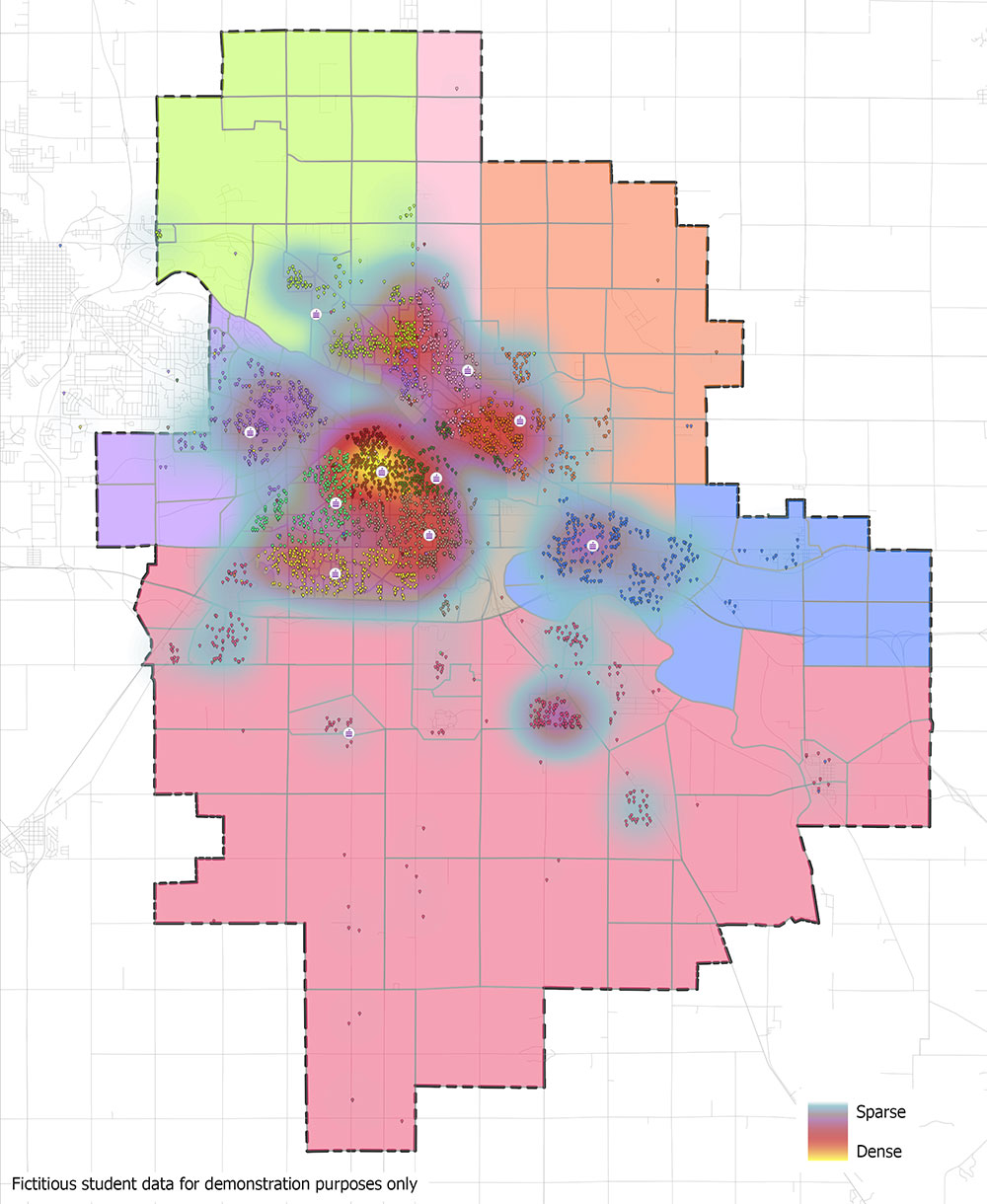
GIS maps:
- Clearly identify students or clients within or outside your boundaries for enrollment or funding purposes
- Help communicate to the public, parents, boards, residents, and constituents
- Are useful in online and desktop software applications
- Help with district master planning
- Allow efficient and accurate sharing of electronic maps and data across partnering entities (county, city, emergency, etc.)
- Facilitate geospatial analysis of district and school data
Map Package Price | |
---|---|
First Map Package (e.g., district boundaries) |
Additional Map Packages of Same District (e.g., elementary, junior high, zones, etc.) |
$999 | $599 |
Boundary Review and Correction Service
Time changes the district’s geography as new structures, freeways, and homes are built. Or, if your neighboring district changes its boundaries, your boundaries need reviewing and updating. Don’t let your official documentation of boundaries get out of date.
Verify that your outer district boundary and school attendance zones are accurate before publishing or printing your maps with our boundary review and correction service.
Boundary Review and Correction Service Prices | |
---|---|
Boundary Review Service | Boundary Correction Service |
$400 plus $25 per school or zone | $200 / hour, min. $400 |