

Software-as-a-Service
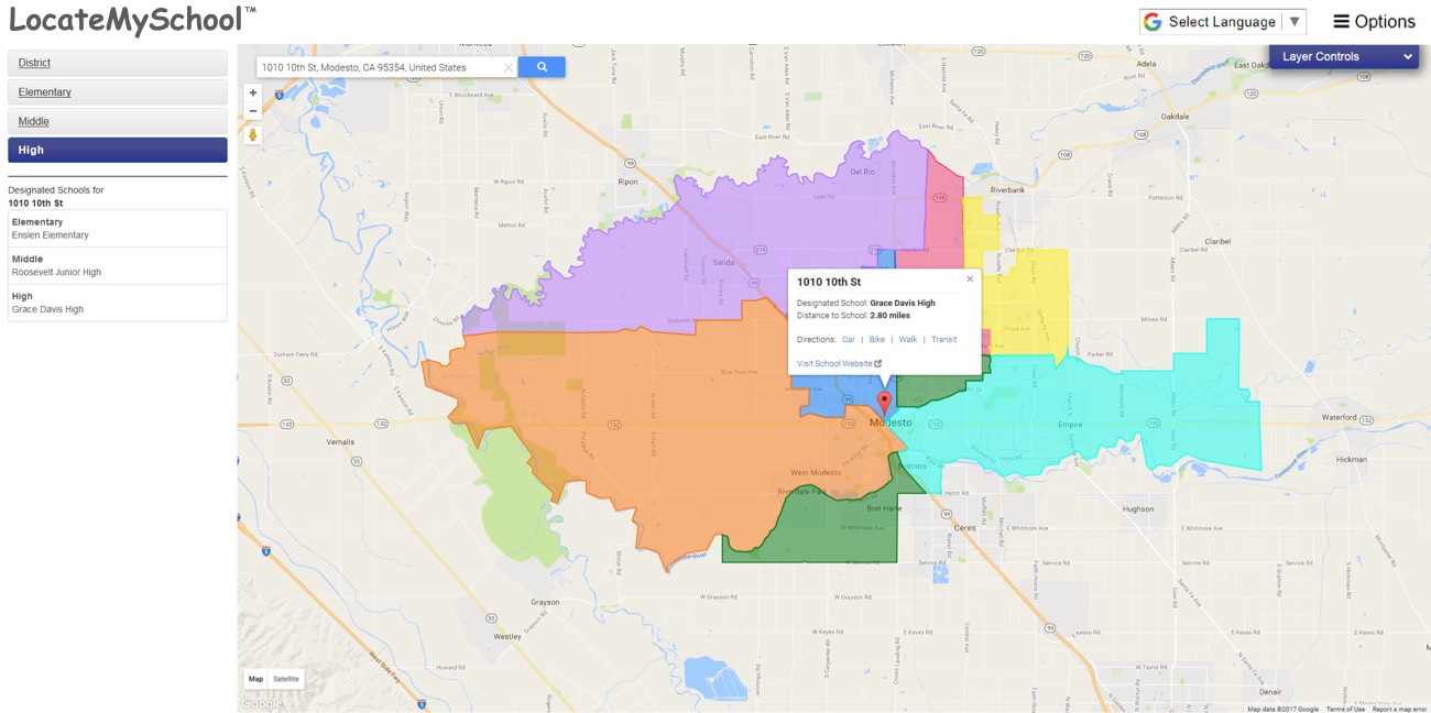
Clarify borders and school coverage with our web-based mapping service. LocateMySchool is a user-friendly online resource that shows parents, students, and school staff the information they need on school assignments and locations by enabling them to identify specific school assignments for any street address in the community.

Software-as-a-Service
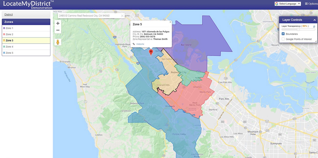
LocateMyDistrict is a web-based mapping service created specifically for special districts with unique boundaries. It serves as a convenient online service to look up and communicate boundaries, directions, and other information about your district. It provides staff a tool at their fingertips to address inquiries, provide information to board members, staff, residents, and constituents.