
LocateMyDistrict™ Software-as-a-Service
What is LocateMyDistrict?
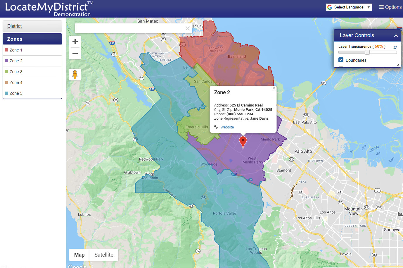
LocateMyDistrict is a web-based mapping service created specifically for special districts with unique boundaries. It serves as a convenient online service to look up and communicate boundaries, directions, and other information about your district.
It provides staff a tool at their fingertips to address inquiries, provide information to board members, staff, residents, and constituents.
Ensure accuracy
We use GIS (Geographic Information System) technology to precisely plot your boundaries on an online map, preventing confusion that can occur when looking at hand-drawn boundary maps. We update your data and boundaries (if there are changes) quarterly, and the map itself will update with new streets periodically based on Google Maps data.
Ease of use
The initial setup is straightforward and painless; provide us with your district and zone boundaries, and we do the rest. The application is simple for the public to use, even for those lacking computer skills. Website visitors enter their address in a search bar to see their zone assignments, get contact and other information, get directions, and even get special points of interest or custom locations in the area. LocateMyDistrict is online, works on desktops, laptops, tablets, and mobile phones for convenient access any time.
How to purchase LocateMyDistrict
Visit our interactive self-guided demonstration site to see how it works by selecting “Demonstration.”
LocateMyDistrict is extremely affordable. Implementation generally takes from four to six weeks.
| Annual LocateMyDistrict Subscription Prices | ||
|---|---|---|
| District Size | Year 1 | Year 2+ |
| 1 to 20 zones | $1,750 | $1,500 |
| More than 20 zones | $1,750 + $100 per site over 20 | $1,250 + $50 per site over 20 |
Additional data layers such as board zones, food pickup locations, bus stop locations, event venues, etc. are available at an additional cost.
Contact us to receive a personalized quote or more details on product features.